Stage 4 meteorite candidates review
Introduction
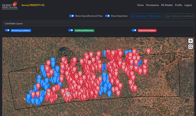
Stage 4 is the in situ visit of meteorite candidates that remain after the remote sensing assessments. To facilitate this, a GPS-enabled slippy map is used. The map has background satellite imagery, with drone survey images overlaid on top, and an interactive layer for the meteorite candidates.
Accessories list
- Android mobile device (1 pp). Need good gyro and compass. Cheap devices (<$500) are usually not suitable for this task (Samsung: S series devices are okay, but not the A series). Most people prefer a tablet over a phone for this task.
- Power bank + charging cable.
- Personal Locator Beacon (1 pp).
- Hand-held UHF radio (1 pp) + charger.
- Garmin GPS unit (1 pp).
- AA batteries.
- Water, clothing, first aid kit etc. as appropriate for the site and conditions.
What to do
Set up
- Install the stage 4 app on the tablet.
- Log in, using same credentials as web version.
Before heading out
- Select a batch of candidates while in internet signal, hit “Cache”.
- Make sure you have all the safety equipment from the Accessories list.
- Do not rely on the app for returning to camp. Set a home point on GPS unit (+ on your phone as backup).
- Let someone know which general direction you are heading towards.
While out
- Check in with others regularly using UHF.
- Revise planned loop if it is taking longer than expected.
Coming back to camp
- Charge devices.
- Synchronise data on mobile device.
- Check up on others.
- Rest.
How to use the Stage 4 app
Android app
Coming soon!
Doc TODO once app is finished.
Web browser version
The web version has more or less the same functionalities as the mobile app, except that it is browser-based. This means that it cannot cache the data very well. Use only if you can maintain an internet connection.